Geospatial Mapping
Filter by
SubjectRequired *
LanguageRequired *
The language used throughout the course, in both instruction and assessments.
Learning ProductRequired *
LevelRequired *
DurationRequired *
SubtitlesRequired *
EducatorRequired *
Results for "geospatial mapping"
 Status: Free TrialFree TrialU
University of California, Davis
Skills you'll gain: ArcGIS, GIS Software, Spatial Analysis, Data Storytelling, Spatial Data Analysis, Geographic Information Systems, Data Presentation, Geospatial Mapping, Public Health and Disease Prevention, Public Health, Land Management, Geospatial Information and Technology, Heat Maps, Data Sharing, Epidemiology, Community Health, Metadata Management, Image Analysis, Project Management, Global Positioning Systems
4.8·Rating, 4.8 out of 5 stars6.4K reviewsBeginner · Specialization · 3 - 6 Months
 Status: Free TrialFree TrialL
L&T EduTech
Skills you'll gain: Geospatial Information and Technology, Spatial Analysis, GIS Software, Spatial Data Analysis, Geographic Information Systems, Geospatial Mapping, Construction Engineering, Database Management, Construction, Construction Management, ArcGIS, Global Positioning Systems, Visualization (Computer Graphics), Decision Support Systems, Building Information Modeling, As-Built Drawings, Survey Creation, AutoCAD Civil 3D, Data Manipulation, Network Analysis
4.2·Rating, 4.2 out of 5 stars50 reviewsAdvanced · Specialization · 3 - 6 Months
 Status: Free TrialFree TrialU
University of Toronto
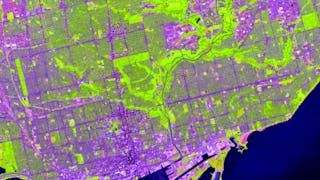
Skills you'll gain: ArcGIS, Spatial Data Analysis, Spatial Analysis, Geographic Information Systems, Geospatial Mapping, GIS Software, Data Mapping, Geospatial Information and Technology, Data Visualization, Metadata Management, Query Languages, Global Positioning Systems, Quantitative Research, Data Compilation, Typography, Data Manipulation, Data Storytelling, Data Modeling, Design Elements And Principles, Image Analysis
4.8·Rating, 4.8 out of 5 stars3K reviewsBeginner · Specialization · 3 - 6 Months
 Status: Free TrialFree TrialL
L&T EduTech
Skills you'll gain: Spatial Analysis, GIS Software, Spatial Data Analysis, Geospatial Mapping, Geographic Information Systems, Building Information Modeling, Data Manipulation, Global Positioning Systems, Network Analysis, Image Analysis, Data Import/Export, Unsupervised Learning, Software Installation, Supervised Learning, UI Components
4·Rating, 4 out of 5 stars30 reviewsAdvanced · Course · 1 - 3 Months
 Status: NewNewStatus: Free TrialFree TrialS
Skillshare
Skills you'll gain: Photography, Photo Editing, Photo/Video Production and Technology, Storytelling, Geospatial Information and Technology, Geospatial Mapping, Geographic Information Systems, Global Positioning Systems, Creativity, Image Quality, Planning, Research, Creative Thinking, Adobe Creative Cloud, Design Elements And Principles, Aesthetics, Critical Thinking, Data Import/Export
Beginner · Specialization · 3 - 6 Months
 Status: NewNewStatus: Free TrialFree TrialU
University of Colorado Boulder
Skills you'll gain: Dashboard, Data Visualization Software, Tableau Software, Data Visualization, Interactive Data Visualization, Data Storytelling, Data Presentation, Data Analysis, Statistical Visualization, Geospatial Mapping, Histogram, Advanced Analytics, Spatial Analysis, Scatter Plots, Data Science, Data Manipulation, Business Analytics, Marketing Analytics, Analytics, Forecasting
Beginner · Specialization · 1 - 3 Months
What brings you to Coursera today?
 Status: Free TrialFree TrialU
University of California, Davis
Skills you'll gain: ArcGIS, Data Storytelling, Spatial Data Analysis, Data Presentation, Geographic Information Systems, Spatial Analysis, Geospatial Mapping, Heat Maps, Data Visualization Software, Network Analysis, Data Manipulation
4.5·Rating, 4.5 out of 5 stars111 reviewsIntermediate · Course · 1 - 4 Weeks
 Status: Free TrialFree TrialL
L&T EduTech
Skills you'll gain: Construction Engineering, Geospatial Mapping, Geospatial Information and Technology, Geographic Information Systems, Spatial Data Analysis, Construction, Construction Management, Visualization (Computer Graphics), Spatial Analysis, Global Positioning Systems, GIS Software, As-Built Drawings, Survey Creation, AutoCAD Civil 3D, 3D Modeling, Data Import/Export
4.8·Rating, 4.8 out of 5 stars16 reviewsIntermediate · Course · 1 - 3 Months
 Status: Free TrialFree TrialU
University of Toronto
Skills you'll gain: ArcGIS, Spatial Data Analysis, Geographic Information Systems, Spatial Analysis, Geospatial Mapping, Data Mapping, Global Positioning Systems, Data Capture
4.8·Rating, 4.8 out of 5 stars2.3K reviewsBeginner · Course · 1 - 3 Months
 Status: Free TrialFree TrialU
University of California, Davis
Skills you'll gain: ArcGIS, GIS Software, Geographic Information Systems, Spatial Analysis, Data Sharing, Geospatial Mapping, Metadata Management, Data Analysis, Data Mapping, Data Quality, Data Visualization, File Management
4.8·Rating, 4.8 out of 5 stars5.8K reviewsBeginner · Course · 1 - 4 Weeks
 Status: NewNewStatus: Free TrialFree Trial
Skills you'll gain: Cascading Style Sheets (CSS), Responsive Web Design, Web Design, Web Design and Development, Hypertext Markup Language (HTML), Usability, Front-End Web Development, User Interface (UI), Javascript, Web Content, User Experience, Geospatial Mapping, Animations
Mixed · Course · 1 - 4 Weeks
 Status: PreviewPreviewC
Coursera Instructor Network
Skills you'll gain: Geographic Information Systems, Geospatial Information and Technology, Geospatial Mapping, Spatial Data Analysis, Spatial Analysis, Global Positioning Systems, Data Analysis
4.5·Rating, 4.5 out of 5 stars17 reviewsIntermediate · Course · 1 - 4 Weeks
Most popular
 Status: Free TrialFree TrialU
University of California, Davis
Specialization
 Status: Free TrialFree TrialU
University of California, Davis
Course
 Status: Free TrialFree TrialU
University of Toronto
Specialization
 Status: Free TrialFree TrialU
University of Toronto
Course
Trending now
 Status: Free TrialFree TrialU
University of California, Davis
Course
 Status: Free TrialFree TrialU
University of California, Davis
Specialization
 Status: Free TrialFree TrialU
University of Toronto
Specialization
 Status: Free TrialFree TrialM
Microsoft
Course
New releases
 Status: Free TrialFree TrialS
Skillshare
Specialization
 Status: Free TrialFree TrialU
University of Colorado Boulder
Specialization
 Status: Free TrialFree Trial
 Status: Free TrialFree Trial
Course


